


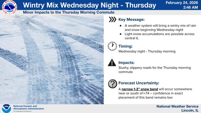
A band of snow is headed for central Illinois Wednesday night into Thursday morning.
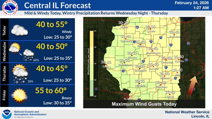
On the WHOW Morning Show Monday, Ed Shimon at the National Weather Service in Lincoln told the Hart Media Group, south winds are currently ushering in much milder air, with temperatures expected to climb well into the 40s but the transition will be quite windy.
By Friday, a major surge of warmth will push temperatures toward the 60-degree mark, though another cold front looms for the end of the weekend. Shimon says Sunday is expected to bring a return to a rain-snow mix with highs dropping back into the 30s.
Central Illinois could really use some rain. Drought monitors right now have central Illinois in a severe drought. Shimon says we could be in for some relief in March. We'll have more on that with him later this week at the Hart Media Group.