


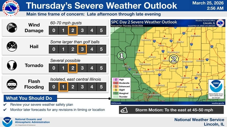
More severe weather is on the way late Thursday evening into Thursday night.
That's according to Ed Shimon at the National Weather Service in Lincoln, who told the Hart Media Group on the WHOW Morning Show Wednesday, northeast Illinois will see the first round of storms before another round develops in the early evening hours.
Temperatures today (WED) and tomorrow (THURS) will gradually warm up to a point where we could see record highs for March. According to Shimon, warm air is pushing up into the area from the southwest.
Keep the radio tuned to The Hart Media Group for those watches and warnings as they are issued. Shimon adds to keep a NOAA weather radio close throughout the evening as well.
Visit weather.gov/lincoln for more on weather forecasts and severe weather outlooks.