


A very nice start to the week will be interrupted by a mid-week cool down before we start to feel more like mid-May, just in time for the May Days Festival in Clinton.
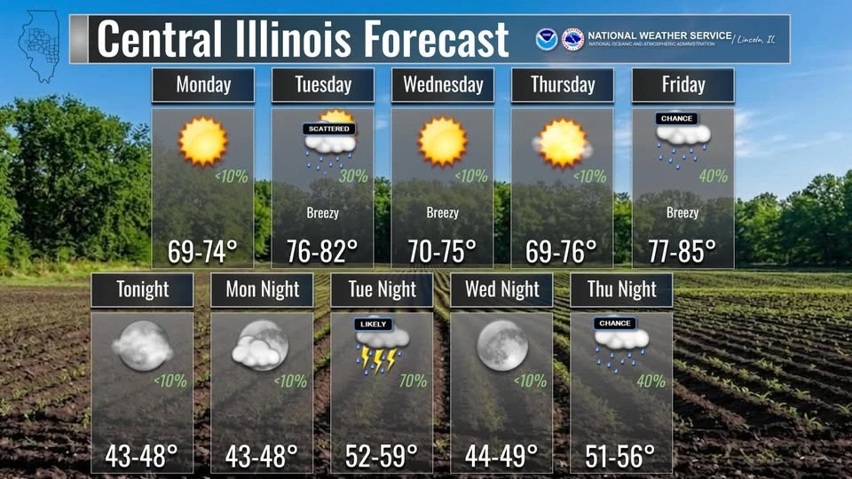
On the WHOW Morning Show Monday, Ed Shimon at the National Weather Service in Lincoln told the Hart Media Group, the week begins on a comfortable note with plenty of sunshine and a high near 71 today. However, a cold front is expected to move through Tuesday evening, potentially bringing a few severe storms.
Wednesday and Thursday will return to quiet, sunny conditions with highs in the low 70s. Shimon indicates rain chances return Friday through Sunday.
Despite a 30 to 50 percent chance of showers throughout the weekend, Shimon says the bigger story will be the heat and humidity. Highs are expected to jump to 83 degrees on both Saturday and Sunday, with dew points climbing into the 60s.
Getting further into May, the outlooks start to show temperatures on the rise. We'll have much more with Shimon on the weather outlooks for May and beyond in the days ahead at the Hart Media Group.