


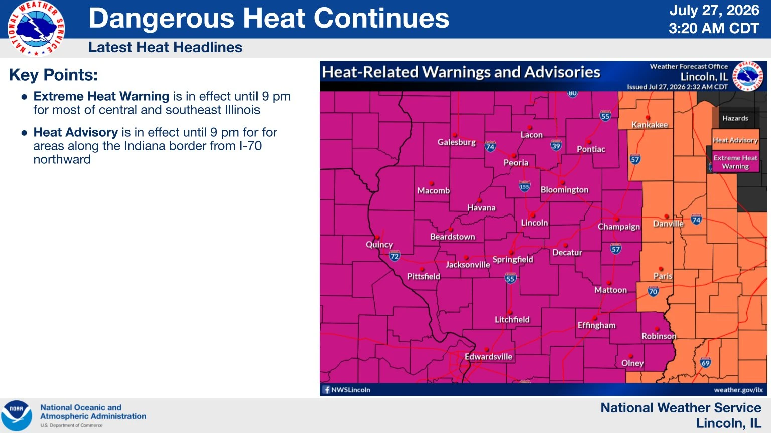
An intense heat wave will overtake the Midwest today, but it will be short-lived.
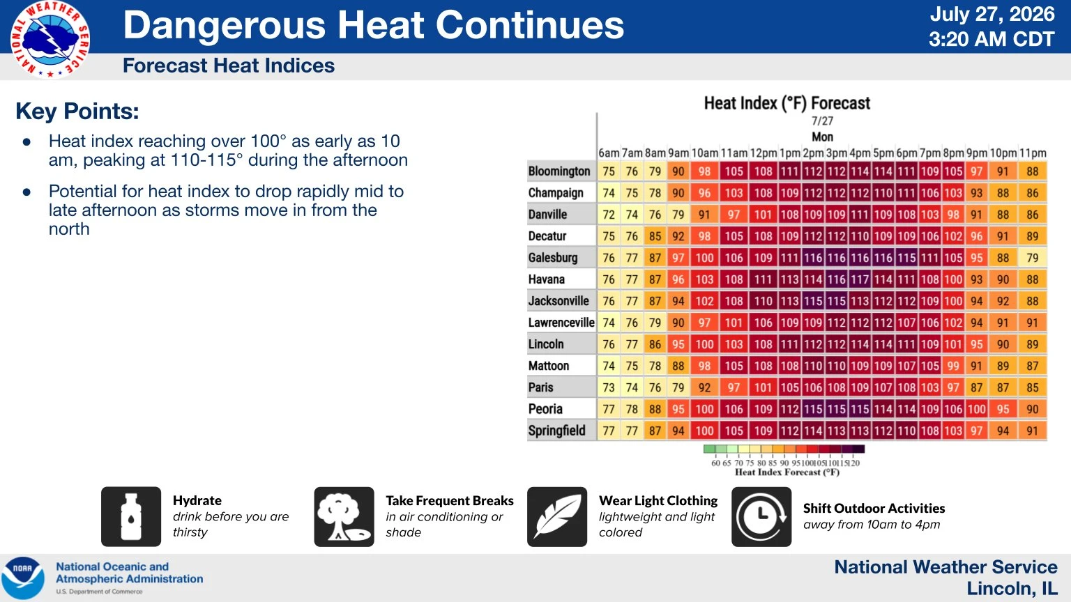 That's according to Ed Shimon at the National Weather Service in Lincoln, who on the WHOW Morning Show told the Hart Media Group a cold front will roll through this afternoon, and that should move the heat out of the area.
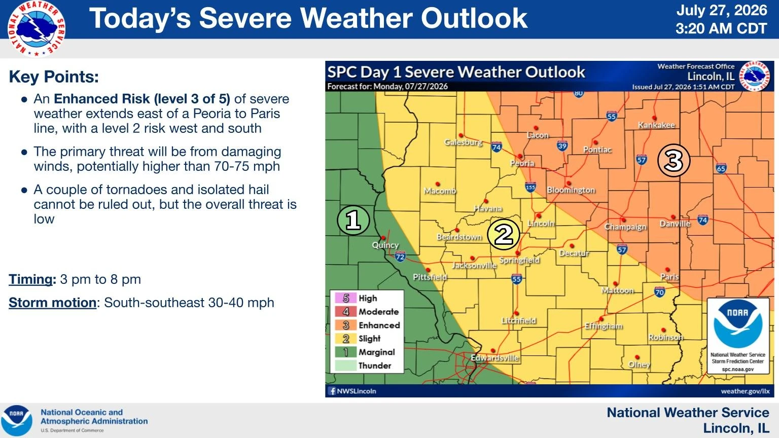 A storm path that was projected to run through parts of central Illinois Monday afternoon has now shifted east. Regardless, Shimon indicates things will become more seasonable the remainder of the week.
Temperatures will drop into the 80s the remainder of the week as we close out July. Shimon indicates Friday is our next best chance to see some precipitation in Illinois.
As we get set to wrap up July, a flash drought is starting to emerge in the area. We'll have more on that with Shimon in the days ahead at the Hart Media Group.